Cruising Past Seventy: The Inner Journeys: Alaska
Showing posts with label Alaska. Show all posts

Tuesday, August 20, 2024

There’s Absolutely No Reason for Breaking Rules When We Travel


I“It’s just for a photo.” “It’s just a tiny piece.” “It’ll just be for a second.” Those were some excuses I used when I violated a rule to get a thrill. Now at 75, I know there is no place for this. 

Snow and Ice in the Yukon 

On the way to Whitehorse, the biggest city on Alaska Highway, between Upper Liard and Rancheria, we saw rocky embankments with many names of people assembled from rocks.  We had just come from the Signpost Forest where ours became the 67,000th addition. I was in the “leaving signs mode” so I pleaded with Bill to stop.  When he did, I quickly collected some rocks and began to form the letters of our names. Bill followed. But it was so time-consuming that we just did two letters: B & C, not British Columbia, not Before Christ, but Bill and Carol. 

Then I saw the sign. It said, “Take nothing but pictures. Kill nothing but time. Leave nothing but footprints.” It was too late. I had already committed the crime. Later, I learned that the warning was to prevent people from displacing too many rocks because that would weaken the wall built to protect the road from onrushing snow or ice.   

The Glaciers of Alaska 

A week later en route to Valdez, Alaska, I remarked “Gosh, the glaciers are puny around here.” There were just tiny patches of white. A few minutes later, as our 24-foot Class C RV was negotiating a bend on the road, a white glistening mountain loomed larger and larger. It was Worthington, a 113-acre road-accessible glacier on Richardson Highway. 

Bill was ecstatic, parked the RV, and began to climb the ice mountain. As usual, I was not as inclined to risk the slippery slopes and shouted for him to bring back a chunk of the glacier. He did. But it was too late when I realized it was quite foolish to break another golden rule, for a block of ice that will not last long anyway and only hug valuable prime space in our RV’s tiny freezer. 

The Littlest Penguins of Australia 

Another opportunity to break another rule presented itself in Melbourne, Australia while I was babysitting my youngest grandson. Every weekend when the young parents were home, I went out to see some sights. One of my first outings was to Philip Island, only a one-and-a-half-hour drive from Melbourne. It’s the home of the world’s littlest penguins, about a foot tall. 

The ranger explained that the penguins waited for dark before they came in after feeding in the ocean. They waited for each other about a hundred meters from shore and waited to form a group for more security against birds of prey. At 5:49 pm, when there were eight of them, they slowly walked into the space between the two viewing platforms. The ranger repeated the rule: No Photography Allowed. But I couldn’t help it. It was the cutest sight. I took a shot.  

The ones who did not swim to feed came out of their burrow to join those who did. Soon they were all around, under the boardwalk. I could not help myself and took a few more shots. I thought I was going to get away with my crime, until a ranger approached me to say, “The penguins do not do well with the light coming from cameras.” I felt so ashamed. I was almost seventy but still unable to follow the rules. 

They are not made to be broken. They are there for a reason. You will be horrified at the consequences when they are not followed. Just look at the tons of plastic floating on the Pacific Ocean. There’s no reason for breaking rules when traveling. There is no reason at all, even when you are not traveling.


Tuesday, April 9, 2024

Would You Rather Go On or Off the Beaten Path?


We have found ourselves amid droves of tourists, all excited about having arrived at a destination like the Eiffel Tower, albeit as older lovers. We have found signs, followed them, and come upon six large charcoal ovens near Ely, Nevada. What gives you more satisfaction: on or off the beaten path? 

A Sense of Accomplishment

Either way, arriving at a destination always gives us a feeling of accomplishment. It is an achievement to have finally reached that place so many others rave about. We may have waited so long to save the dollars we needed to get there, sacrificing plenty. On the other hand, think of the risks we had to take to go off-the-beaten path: driving through a dirt road for miles to reach the Arctic Circle on Canada’s Yukon, suffering temperatures well below zero to catch the Northern Lights, or even climbing Mount Everest at the peril of death.

The Feeling of Amazement

More than this sense of accomplishment, we get the undeniable feeling of amazement when we reach a destination. When I got a glimpse of the Roman Colosseum, I marveled at the engineering feat built to today’s standards 2,000 years ago. At the Arctic Circle, I could not explain the feeling any better than with these words I have that capture the moment: “Sometimes you find yourself in the middle of nowhere. And sometimes in the middle of nowhere, you find yourself.”

The Feeling of Disappointment

Other times, however, I was forced to sigh,” What’s all the fuss about?” When I laid eyes upon the Manneken Pis in Brussels, Belgium, that tiny statue of a little boy taking a pee into a pond below, I was utterly disappointed; even more so when I found out later it was just a replica! But I didn’t say anything aloud. The huge throng was seriously engaged in taking masterpieces of a souvenir photo.

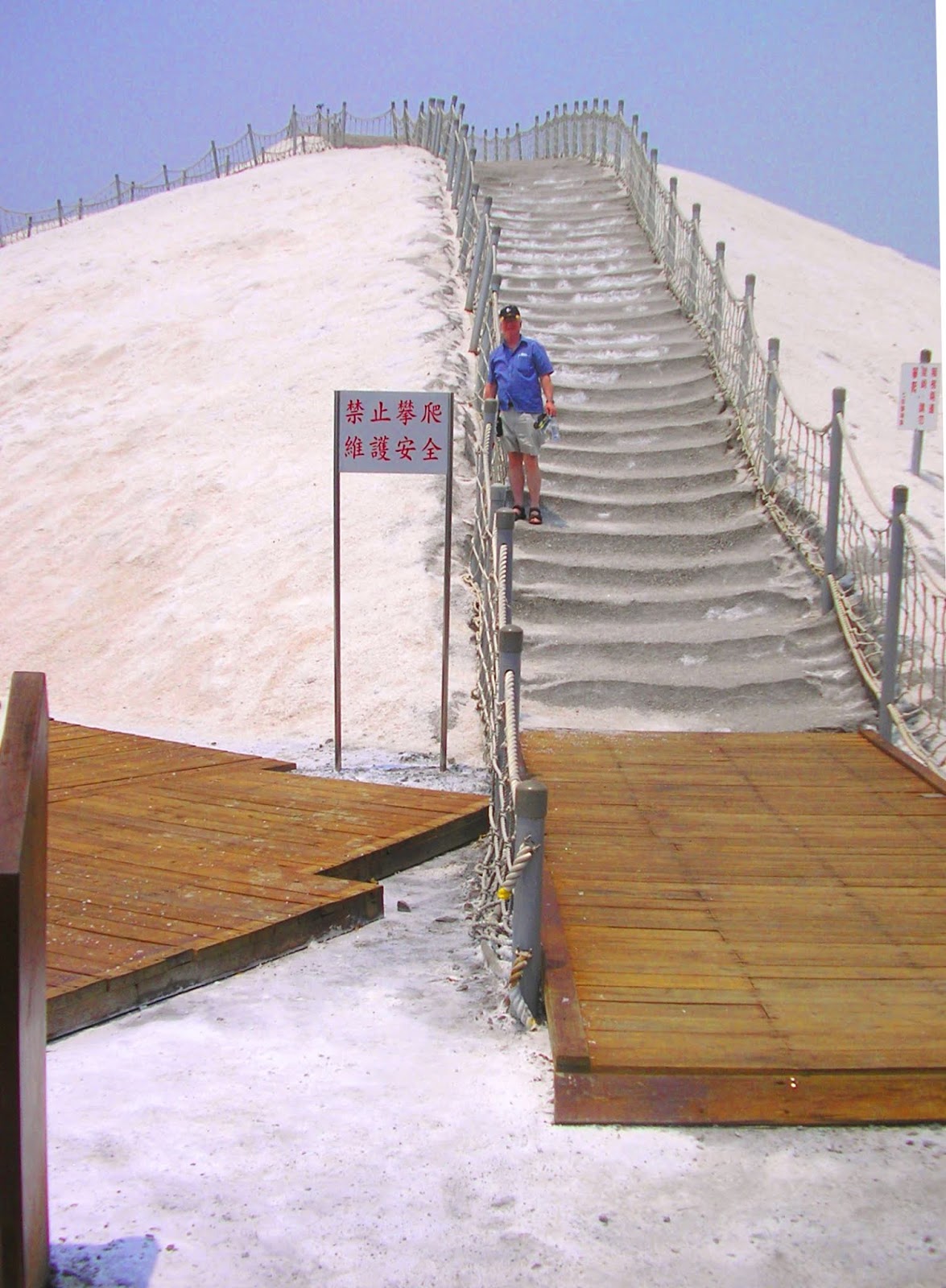
But the disappointment is even much bigger when I go through all the trouble and/or take many risks to reach somewhere off the beaten path. For example, to get to the Chigu Salt Mountain in Tainan City, Taiwan, we had to ride the expensive but fast bullet train from Taipei in the north and then take the only bus, where the driver, conductor, and passengers didn’t speak any English, to the outskirts of Tainan. This same bus went back only once, late in the afternoon.

Comments on its website like this more than express our disappointment: “Honestly! I had to spend 1 hour and 10 minutes on the bus to get there! And the last bus left at 18:10! What for? for a mountain of "salt" black of air pollution...nothing very amazing there! “

Finding a Saving Grace

We didn't want to wait four more hours for that one bus, so we called for a taxi. The driver, noticing we were hungry (the museum only had coffee), stopped, got out, took something out of the trunk, and gave us the most wonderful cookies we have ever tasted. Had we not gone to the Salt Mountain, we would not have met this extraordinary man! In Brussels, Bill’s saving grace was Belgian beer; mine, Belgian chocolates, and ours, waffles.

The question is not whether I would prefer to go on or off the beaten path. I will keep on doing both and you should, too. It doesn't matter how much expense or preparation we need to get to either. We can never guarantee anything in life. What matters most is to always have the right attitude when we get there. Then you may feel a sense of accomplishment, amazement, or a saving grace.

 
Bill climbing the Salt Mountain

PREVIOUS POST
Family Fun at a Farmhouse in Temecula Wine Valley

FOR MOBILES, click "View Web Version at the end of the post past comments and share buttons will appear.


Tuesday, March 12, 2024

Beyond Being Tourists


My husband and I have traveled together since the time we met in July 2007. We began as tourists, traveling for pleasure, visiting places out of curiosity.  We became more serious travelers when we bought an RV, rented out our condos, and cruised through forty-nine American states, nine Canadian provinces, and six Mexican states. It’s all chronicled in the book Carolina: Cruising to an American Dream. The RV gave us the wherewithal to become more than tourists. We became explorers, adventurers, and even pilgrims.

An Explorer is defined as a person who combs an area for discovery. When we became Elite Members of Thousand Trails (a nationwide network of campgrounds) and upgraded our RV to a 37.5-foot motorhome towing a dinghy, we stayed three to four weeks at a place. This gave us the chance to explore an area more completely. I would research the places nearby and schedule daily explorations of the areas within three hours of our base camp.

In Ontario, Canada, for example, we saw all four different faces of the province: a government hub in Ottawa, a bustling metropolitan center in Toronto, a famous tourist spot (Niagara), and the rural town where we were camped. In Europe, we got to go to three countries from our base in the small town of Oberstaufen in Germany. The trains allowed us to visit Switzerland (St. Gallen), Lichtenstein (Vaduz), and Innsbruck (Austria).

An Adventurer, on the other hand, is a person who has, or seeks, activities or places for excitement or an unusual experience, despite the risks they may entail. I must admit that Bill is more of an adventurer than I am. He used to scuba dive, ski, fly a plane, etc. I just play with my smartphone or laptop, an armchair sort of a girl.  I’ve tried playing tennis and pickleball, but they didn’t like me. Does riding the helicopter in Kauai or taking our RV to the Arctic Circle in the Yukon count?

When we stumbled upon the Worthington Glacier on the road to Valdez, Alaska, Bill went up to climb it while I stayed behind, scared I might hurt myself or be frozen. When we went with his high school friends for a reunion in Crested Butte, Colorado, he went wild river rafting with his friends while I stayed behind to write about the reunion instead. At Grandfather’s Mountain near the Blue Ridge Parkway, Bill negotiated the Mile-High Swinging Bridge while I took his photo.

A Pilgrim is another kind of traveler. This is a person who journeys, especially a long distance, to some sacred place as an act of devotion or even as an original settler. Once, being both Catholics, we diverted from our planned itinerary to Minnesota and turned west instead of north to visit the Grotto of the Redemption in the northeastern corner of Iowa. It was off the beaten path, but we wanted to see the complex of nine grottos made from forty-three different kinds of gems individually gathered and built entirely by the hands of three men.

A friend and I became accidental pilgrims in Eastern Europe. We were in Razlog, Bulgaria visiting a beautiful Eastern Orthodox Church in nearby Bansko when she suddenly had a yearning to find a Catholic Church. The nearest one was in Skopje, Macedonia, three and a half hours away, where Mother Teresa was born. We hired a taxi, prayed at the Chapel attached to her house, and visited the Church of the Black Madonna where she heard her calling at 18 in Letnice, Kosovo, an hour and a half away. The way home was through Nis, Serbia, birthplace of the first Christian Roman Emperor and Saint, Constantine the Great.

Indeed, we both had become explorers but I will not be the adventurer that Bill is. But we hope to be more of pilgrims. It is time for deepening our faith in this phase of our lives. Which of the three kinds of traveler do you want to be?


Tuesday, October 10, 2023

TRAVEL AWAITS: 6 Quaint Small Towns To Visit While Exploring Kenai Peninsula in Alaska


This article was first published in Travel Awaits on Aug. 14, 2023.

As America’s last frontier, Alaska is well-known for spectacularly wide-open spaces teeming with amazing wildlife, ideal for both cool and cold outdoor fun.  Half of Alaskans live in Anchorage but it’s the quaint small towns that can give you the true Alaskan experience. North of the city are interior towns born out of its mining history. To its south, however, are communities rich in Russian cultural heritage with abundant fishing waters, glacial fields, and beach ports for Inside Passage cruises.

There are 36 such towns located on the Kenai Peninsula in the south-central part of the state. It has been called Alaska’s playground, “where mountains, ice, and ocean meet.” Bounded to the west by the Cook Inlet and to the east by the Gulf of Alaska, the Kenai Mountains lie on its western side, creating the natural bounty called the Kenai Fjords National Park. The jewel of the park is the famous Hardings Ice Fields. There are also six great rivers and over 50 lakes. At its southern tip, Kachemak Bay State Park  was Alaska’s first legislated state park. Together with the Kachemak Wilderness Park , they comprise 400,000 acres around the pristine waters of Kachemak Bay.

My husband’s daughter and my sister both lived in Anchorage, and visits to each of their homes have blessed us with opportunities to explore this incredible state. Our first visit to Kenai was so much fun that we went back for more the following year. In the following paragraphs, we share Cooper Landing and Homer from the first visit; then Kenai, Soldotna, and Seward from the second. But first, Whittier.

1.  Whittier


The 14-mile isthmus that connects Anchorage to the Kenai Peninsula is called Portage Valley. It is on a waterway called Turnagain Arm. The Portage Glacier once sat here and its remnants can still be seen today. The ghost town of Portage, about 47 miles south of Anchorage, is what remained after the 1964 Alaska earthquake.

An alternating railroad and road passageway was built here linking Seward Highway and Alaska Railroad to the Portage Glacier Park and the town of Whittier. It was quite an experience to pass through this Anton Anderson Memorial Tunnel.

Only about 60 miles southeast of Anchorage, the small town of Whittier is technically not part of the Kenai Borough. It sits on the northeast shore of the peninsula at the head of the Passage Canal, a port for the Alaska Marine Highway. Off-season, 272 people make it home, doubling in summer. Nestled between glacier-draped mountains, the town is the charming gateway to Prince William Sound on the Gulf of Alaska. Several cruise lines use it as a departure port for their famous four-hour Inland Passage cruises.

Pro-Tip: Our cruise took us up close to 26 glaciers on Resurrection Bay and the College Fjords. The high-speed catamaran had huge picture windows inside and extensive outside viewing decks. This is the less expensive way to explore these glaciers (rather than to cruise all the way from Seattle) and it gives you the chance to explore the peninsula.

2.  Cooper Landing


Straight south on Seward Highway about 100 miles from Anchorage, you will come across a centrally located census-designated place about the same size as Whittier: Cooper Landing. Because of its scenic location at the outlet of Kenai Lake into the Kenai River, it has become a popular tourist destination and a fisherman’s playground near the area’s salmon fishery.  

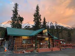
Pro Tip: You can get great fish and chips and the best-smoked salmon chowder you will ever find (just $10 a bowl) at historic Gwin’s Lodge, established in 1952 (even before Alaska became a state). You can find this oldest surviving roadside lodge on the peninsula at the confluence of the Kenai and Russian Rivers.

3.  Homer


My husband, his daughter, her son, and I continued to the southern tip of the peninsula just two hours away, to the quaint town of Homer, fondly called the “halibut fishing capital of the world.” Over 5,000 people reside on the foothills of the southern Kenai Mountains, overlooking a beautiful spit jutting out into the cold blue waters of Kachemak Bay. There the grandfather and grandson fished to their hearts’ content while I lost track of time taking photos of them and the wondrous seascape. At night we let the Inn’s chef turn their catch into a fish fest.

Perched in colorful huts above the waters along the spit shore were quaint shops and restaurants. It made a very lovely place for souvenir hunting and snacking. I could not resist having my photo taken with the largest halibut (almost 200 pounds) caught in a derby that day.

Pro Tip: Here we found the iconic Salty Dawg Saloon, perfect for drinks and dinner. The place is famous for its ceiling and walls covered with currency. I posted my Philippine Peso 100 bill, and the rest of the group, a U.S. Dollar. We hoped they would both still be there when we go back!

4. Kenai and 5. Soldotna


My husband’s daughter met somebody wonderful so the following year, we were back in Alaska for her wedding! When the brand-new couple went on their honeymoon, the grandpa, grandson, and I tried to replicate the previous year’s fun times and drove for three hours just slightly off the same road to Homer the previous year. They wanted to fish again, this time at the coastal capital town of Kenai (population 7,000) and its twin town Soldotna (5,000) at the western mouth of the Kenai River leading into the Cook Inlet.

Being late in the summer though, it was already colder, wetter, darker, and windier. There was not much fishing to do in this, Alaska’s renowned fishing area. The snow-capped mountains seemed farther away, hidden by haze. Even my photos turned out less bright.

But at Old Kenai Town, our disappointment suddenly went away. We were entranced by the historic church, built at the turn of the 19th century when the land was still under Russian rule. Alaska only became a state in 1959 (Russia sold it to the US in 1867 for $7.2 million). At the gilded Holy Assumption Russian Orthodox Church, we even found a set of wedding crowns we wore for a souvenir picture.

Pro-Tip: In Soldotna, we rejoiced at finding a local Fred Meyer which had complimentary dump and potable water stations. We loved camping there for the night and shopping for provisions in the morning.

6.  Seward


Sensing my disappointment in the weather, instead of going back to Anchorage my husband headed off to the eastern side of the peninsula. Less than two hours away is the small quaint town of Seward (population 3,000), sitting at the mouth of the Kenai Fjords National Park. It is another lovely cruise ship town nestled between the mountains and the fjords. It was already off-season, however, so there was hardly a soul on the waterfront. But the boats were all still moored in the marina; the shops were still open; and tours to the Kenai Fjords were still running!

Soon I would be treated to one of the great experiences of my lifetime. A sign led us to the Exit Glacier only eight and a half miles west of town. Considered the toe of the 500-square-mile Harding Ice Fields, it is so named because it has been receding slowly since the earliest recorded terminus in 1815. There were recordings all along the way, the last about two miles from the present one. You can imagine the former size of the glacier from the marshland being created at its feet.

On that massive ice, I got a second chance to walk on a glacial ridge. The previous year I had chickened out when we came upon the Worthington Glacier en route to Valdez. This time, I summoned enough courage to experience the thrill. But it was so cold, it felt like I was inside a freezer. I turned back after one quick photo op!

Such are the charming discoveries we made all over this beautiful peninsula. It’s a place where disappointments don’t last long. An abundance of small quaint towns collectively makes it an unforgettable vibrant playground.

FOR THOSE ON MOBILE, THE SHARE BUTTONS APPEAR WHEN YOU CLICK WEB VERSION AT THE VERY END AFTER COMMENTS.

PREVIOUS POST 

IN HAWAII: Renewal of Vows on Oahu and 2nd Honeymoon on the Big Island


Monday, January 30, 2023

TRAVEL AWAITS: 8 Tips For An Epic RV Road Trip On The Alaska Highway


This story was originally published in Travel Awaits on May 10, 2022 

One of the very first items my husband wanted to cross off his bucket list after we bought our first RV (a used 26-foot Class B Telstar by Firan) was to drive the Alaska Highway. So when we finished showing off our new "home" to our children in Seattle, Boise, Denver, and Calgary, we were excited to drive to the one in Anchorage. Banff and Jasper National Parks, two of four UNESCO World Heritage Sites in the Canadian Rockies, were right on the way, so we briefly explored them. And, after Jasper, we braced for the rugged trip, what my husband promised would be my first epic road trip in an RV.

Make Her Part of the Family


By this time, I had begun calling our new “moving mansion," Star. She took us through the winding roads of northern British Columbia which gave me my first close encounters with North American wildlife I had never seen before except in zoos. A herd of bison lay peacefully by the roadside but one of them decided to walk towards Star. I huddled inside and that’s where I stayed because soon a mother and her baby bear showed up among the grass and wildflowers. It was good the big moose hiding in the shrubs was at a distance. Following a small arrow sign, we stumbled upon a multitude of birds and insects by a river.  I finally found the nerve to step outside Star!

When we reached Dawson Creek, British Columbia, we could not contain our excitement. The small town of about 13,000 is Mile 0 of the Alaska Highway! Her bragging rights were all over. I asked my husband to take my picture at the signs declaring the official start of the Alaska Highway and I wanted to mark the huge milestone with Star.

Pro-Tip: Make sure your RV is fully prepped for the trip: tires, generator, batteries, oil, roof, grey and black water tanks, etc. And make sure the kitchen is fully stocked for a week.

Familiarize Yourselves with the Road 


The next town was five hours away at Mile 300. Even smaller,
Fort Nelson, British Columbia, the administrative center of the Northern Rockies Regional Municipality, had a population of about 3,500. It hosts the Fort Nelson Heritage Museum which explained how the Alaska Highway actually began there, how the US and Canada cooperated in the building and how they divide the maintenance today. The 1,422 mile-long highway has connected Alaska to the lower 48, militarily strategic in WWII and economically so now. 

Pro-Tip: There will be no mileposts for the first 1000 kilometers. You will cross the British Columbia/Yukon border several times before reaching the first big town of the pristine and primitive province of the Yukon.

Learn about Services and a Few Tricks


On the way, we stumbled upon “a highway service community,” those small villages that support the travelers on the highway.
Toad River consisted only of a gas station, a restaurant, and a country store. It was a place to enjoy local fare and to fill up Star. A section of the store was dedicated to thousands of hats, and my sentimental husband didn’t hesitate to leave what he had on.   

About a hundred miles north, we saw another arrow we could follow! It led us to the Whirlpool Canyon with a river that made a powerful swirl as it wound its way around a bend. A Canadian couple who were making their way to fish in Nunavut past the Arctic Circle, taught us about not being shy to dump gray water (from washing dishes and showering) almost anywhere, and drinking creek water, if necessary, as long as we were sure there was no beaver contamination. 


Pro-Tip: Before reaching The Yukon, you will encounter The Summit, the highest point on the Alaska Highway, at 4,250 feet. The area is called the Serengetti of North America. Feast on views of Stone Mountain, and Muncho Lake. Stop for photos at the Liard River Hot Springs Provincial Parks.

Give Yourselves Rest and Fun


Watson Lake, Yukon
was an even smaller town of about 800 at Mile 635 and we loved the good night’s rest at the Downtown RV Park. The next day we thoroughly enjoyed being the 67,000th visitor to place a sign (there are over 80,000 now) at the unique Signpost Forest. We bought a wooden board at a Home Builders’ Centre in town and got free paint from the Visitor’s Information Centre. That’s also where we registered as Yukon Gold Passport holders which will give us 5, 10, or 20 troy ounces of gold if we collected 10, 20, or 30 stamps of tourist spots.

Along the highway between Watson Lake and Whitehorse were rocky embankments (between Upper Liard and Rancheria) that are being used to arrange rocks into letters memorializing passersby. We originally thought we could spell out our names, but we found out how difficult the endeavor was and ended up with just the two letters of our first names: BC. On the way back to the mainland US, the letters were still there!

Pro-Tip: Don’t make the mistake of going to the Northern Lights Center in Watson Lake. Even with displays about the Aurora Borealis, it was really a brief video of the lights recreated on the dome ceiling for effect, not worth the time or money.

Give Her a Good Mid-Point Check


At Mile 918 we reached
Whitehorse, the biggest city in the Yukon with a population of about 25,000.  Many places, including the biggest fish ladder in the world, were already closed for the season. But our main purpose here was to give Star a thorough mid-point check-up for the shorter but harder second half of Alaska Highway.

We were fascinated at finding the largest weather vane in the world (in the Guinness Book of Records)! It was a DC3 plane! Smith House at LePage Park gave us two souvenir Whitehorse pins. And we got to chance to climb aboard one of the only remaining steamboats that transported precious metals on the Yukon River at the SS Klondike National Historic Site.

Pro-Tip: This is the only place on the Highway where you can dine at a branch of Tim Horton’s, Canada’s favorite coffee chain. Get a bowl of chili!

Go Slow for Two Reasons


From Whitehorse, smoke from 50 fires around the Yukon (since it had been so hot and dry that summer) obscured all the beautiful scenery.  We could hardly see anything beyond Star’s nose! In fact,
Burwash Landing, population of just over 70, including most of its wildlife displays and artifacts, was almost wiped out by a huge forest fire caused by humans camping (although lightning is the more common cause).

Another unfortunate thing is the road damage caused by permafrost effects, especially after Destruction Bay. There were many road fissures and small ponds on the fields along its sides. The highway had a roller coaster feel to it, and evergreens in nearby fields could not grow any taller than a few feet.  Orange flags were everywhere, designating permafrost-damaged areas. The cost of maintaining these roads must be high. And they exacted a toll on Star. 


Pro-Tip: Stop to view 
White River, so named because of its off-white color due to volcanic ash from two pyroclastic eruptions of Mount Churchill in the Wrangell Mountain Range, in 1890 and 1950. Alas, the ecology could not be restored; the river can no longer be used for boating.

Don’t Succumb to “Get-there-itis”


We finally reached the Yukon’s Haines Junction at Mile 1016, but it was not what we expected. We were supposed to be able to get a glimpse of the Juneau glaciers and the highest mountain peak in Canada.  We couldn’t because of all the smoke. We decided to stop for the day at the Kluane RV Park.

The village, with a population of a little over 600, is east of the Kluane National Park and Reserve. We looked for a good hiking trail. We thought we did but we had to quickly go back to Star after finding the mosquitoes were so big and hungry.  But it was good we found a quaint Quonset hut that also served as a church for as many as 30 people. We hoped for a clearer tomorrow.

The next day was clearer and we resumed our trek. We passed Mile 1202 at Beaver Creek, Yukon (population, almost a hundred). Soon we reached Delta Junction, Alaska, (population, almost a thousand), the official end of the Alaska Highway. The sign at the Visitor Center said it all. From Mile 0 in Dawson Creek to Mile 1422 in Delta Junction, we completed the Alaska Highway in seven days.  It was the rugged one-of-a-kind trip my husband promised, the  unforgettable epic first RV experience of this former “desk jockey.”    

Interesting Fact: Constructed at a total cost of $115 M in about nine months, at its peak the project utilized 7 Army regiments and 77 Contractors with 15,000 employees and 11,000 pieces of road-building equipment. Two teams, one from Dawson Creek and another from Delta Junction completed the highway when they met at Soldiers' Summit at the Kluane Lake in the Yukon in November 1942.    


FOR THOSE ON MOBILE, THE SHARE BUTTONS APPEAR WHEN YOU CLICK WEB VERSION AT THE VERY END AFTER COMMENTS.

PREVIOUS POST

6 Unique Dining Experiences in the Shrimp Capital of the World


Friday, September 9, 2022

TRAVEL AWAITS: 6 Charming Small Towns to Visit in Southern Alaska


 The full article was published in Travel Awaits on Dec. 30, 2021

On our first trip to Alaska, we made a detour to Valdez in the southeastern corner. Then from Anchorage, we did day trips to the towns of Whittier and Homer. And on the way back to the Lower 48 through British Columbia, we found the tiny town of Hyder. The next year we went to the towns of Kenai/Soldotna and Seward. This is the second of two articles on my favorite small towns in Alaska, covering the south. The northern towns were featured previously in 6 Quaint Small Towns To Visit North of Anchorage, Alaska.

1. Valdez

We completed navigating the famed Alaska Highway in a week. After a night at a campground in Tok, Alaska, we woke up to a day covered with smog from the forest fires that were raging all around. Quickly we postponed seeing my husband’s youngest in Anchorage for a few days and drove to Valdez in southeastern Alaska first.


There were a few showers on the way there; the air was damp and a lot of fog hovered around. Soon we lost our cell signals and broadband communications. Suddenly, as our RV negotiated a bend, a large white mountain appeared before us: It was Worthington Glacier, and one could walk to it from the roadside! My husband was gone in a jiffy, bringing back a chunk of blue ice that I quickly deposited into our freezer.

Thirty minutes from Worthington is the quaint little fishing town of Valdez (population of almost 4,000). Low-lying clouds encircled the town and the lovely marina. The “longest boat ramp in the world” reached far out into the waters teeming with pink salmon spawning nearby. Eager fishermen lined the banks around Allison Park where we camped.

Up in the hills where the trails wound, we came across a section of the Alaska gas pipeline. But more remarkably, we saw three young men in flip-flops hauling a canoe, heavy with provisions and equipment, up the steep trail to camp in the mountains. And the hiking trails were filled with berry bushes that the bears had clearly ravaged earlier.

Pro Tip: On the way back, if you have time, visit Wrangell-St Elias National Park, which hosts the Canadian Rockies’ highest point, or, nearer to Anchorage, walk on the 27-mile-long Matanuska Glacier.

2. Homer


Anchorage was the neat city we expected it to be. From there, our extended family group took a trip to Homer, Alaska, the “halibut fishing capital of the world,” at the southwestern tip of the state, with over 5,000 in population. It has a famous spit jutting out into the cold blue waters of Kachemak Bay.

There, my husband and his eldest grandson fished to their hearts’ content. At night we let a chef serve us a fish fest. The next day we went hunting for souvenirs and good eats at the quaint shops and restaurants perched in colorful entrancing huts above the waters along the shore. Afterward, I could not resist having my photo taken with the largest halibut (almost 200 pounds) caught in a derby that day.

Pro Tip: On that second night we had a few drinks at the Salty Dawg Saloon on the spit, famous for its ceiling and walls covered with currency. I posted my Philippine peso 100 bill, and my husband and his daughter put up a U.S. dollar.

3. Whittier

When the grandson left to go back to his job in Hawaii, my husband, his daughter, and I proceeded to experience the famous four-hour Inland Passage. A number of cruise lines use Whittier, the charming gateway to Prince William Sound nestled between glacier-draped mountains, as a departure port for these cruises. Only about 60 miles southeast of Anchorage, Whittier is a very pretty town on the western edge of south-central Alaska. Its population is about 200 people in the off-season, which doubles during summer. It is separated from Alaska’s road system by a 2.5-mile-long tunnel that is shared by alternating one-way auto and railroad traffic. Quite an experience.


Our cruise took us to see 26 glaciers up close, some rising to 1,700 feet above sea level. We rode in a high-speed catamaran with huge picture windows inside two enclosed decks (there are extensive outside viewing areas, too). The voyage visits Resurrection Bay and the College Fjords. There were lots of sea otters, seals, porpoises, sea lions, and whales. We were fittingly surprised as we approached Surprise Glacier, a very blue tidewater glacier, pieces of which were floating on the icy waters around the vessel (think shades of Titanic). When the crew served glacial blue margaritas from ice they harvested, we had a party!

4. Hyder

On the way down to the Lower 48, we took the Stewart-Cassiar Highway through northern British Columbia. I did not see a glacier-topped mountain until the turn to the town of Stewart, British Columbia, toward the coast, where there was supposed to be good fishing.

There was nothing commercial about the town of Stewart/Hyder. No one wanted to take Bill out fishing because it was already a day after the season. I was so disappointed until we found out that, only two miles away, was the intriguing tiny town of Hyder. The little town of about a hundred people surprised us with two unplanned and unforgettable experiences: Salmon Glacier and Fish Creek.


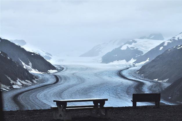
Salmon Glacier is the fifth largest glacier in North America, and as we went up the hill (15 miles) from downtown Hyder and Stewart, it slowly made its appearance. The pictures I took could not capture the entire extent; they could not do it justice. And the price we paid was high. The road was dirt-gravel all the way; and since it was also raining, it was muddy dirt/gravel! I can only imagine the brutal punishment we gave our small Class B motorhome. But there was no other way to get there.

Fish Creek Bear Viewing Site, on the other hand, right at the foot of the hill, had a sideshow waiting for us. A good-sized black bear showed up, and for about 39 minutes hunted for and devoured all the salmon he could find. My husband and I were clicking our cameras non-stop. At times he was a mere 20 feet away. Good thing we were hidden; he put on quite a show!


5. Kenai/Soldotna

The following year, we went back to Alaska for the wedding of my husband’s daughter! When the couple went on their honeymoon, we tried to replicate with the grandson the fun times we had the previous year. We drove to the twin towns of Kenai (population 7,000) and Soldotna (population 5,000) at the mouth of the famous Kenai River on the Kenai Peninsula, just slightly off the same road we took to Homer the previous year.


 Being late in the summer, however, it was already colder, wetter, darker, and windier. There was not much fishing to do in this renowned fishing area of Alaska. Even the snow-capped mountains seemed farther away, hidden by haze so that the pictures we took were not as bright. In Soldotna, the only thing that caught our attention was that the local Fred Meyer, where we camped for the night, had a complimentary dump and potable water stations.

But we discovered an entrancing and historic church built at the turn of the 19th century when the land was still under Russian rule. Alaska only became a state in 1959 after Russia sold it to the U.S. The Holy Assumption Russian Orthodox Church in the Old Town of Kenai was so endearing. We even found a set of wedding crowns we could don for a picture.

Pro Tip: On the way to Kenai/Soldotna, you can get the best-smoked salmon chowder you will ever find at the historic Gwin’s Lodge in Cooper Landing.

6. Seward

The next morning, sensing my disappointment in the weather, my husband headed off to the other side of the peninsula, to the town of Seward (population 3,000) at the mouth of the Kenai Fjords National Park instead of going back to Anchorage. Another lovely cruise ship town nestled between the mountains and the fjords, I felt that Whittier was prettier though smaller. It was already off-season, however, so there was hardly a soul on the Seward waterfront. But the boats were all still moored in the marina, and the shops were still open. And tours to the Kenai Fjords were still available.


Upon leaving town, a sign led us to a certain Exit Glacier only eight and a half miles west. Of course, we took the detour. We found out it is part of the 500-square-mile Harding Ice Fields and is so named because it has been receding slowly since the earliest recorded terminus in 1815. There were recordings all along the way; the last about two miles from the present one. You could imagine the former size of the glacier from the marshland it was creating at its feet. And I got a second chance to walk on the glacial ridge. I finally summoned the courage. But it was so cold; it felt like I was inside the freezer. I turned back after the quick photo op!

Such are the charming discoveries we continue to make all over beautiful Alaska. It’s a place where disappointments don’t last long!